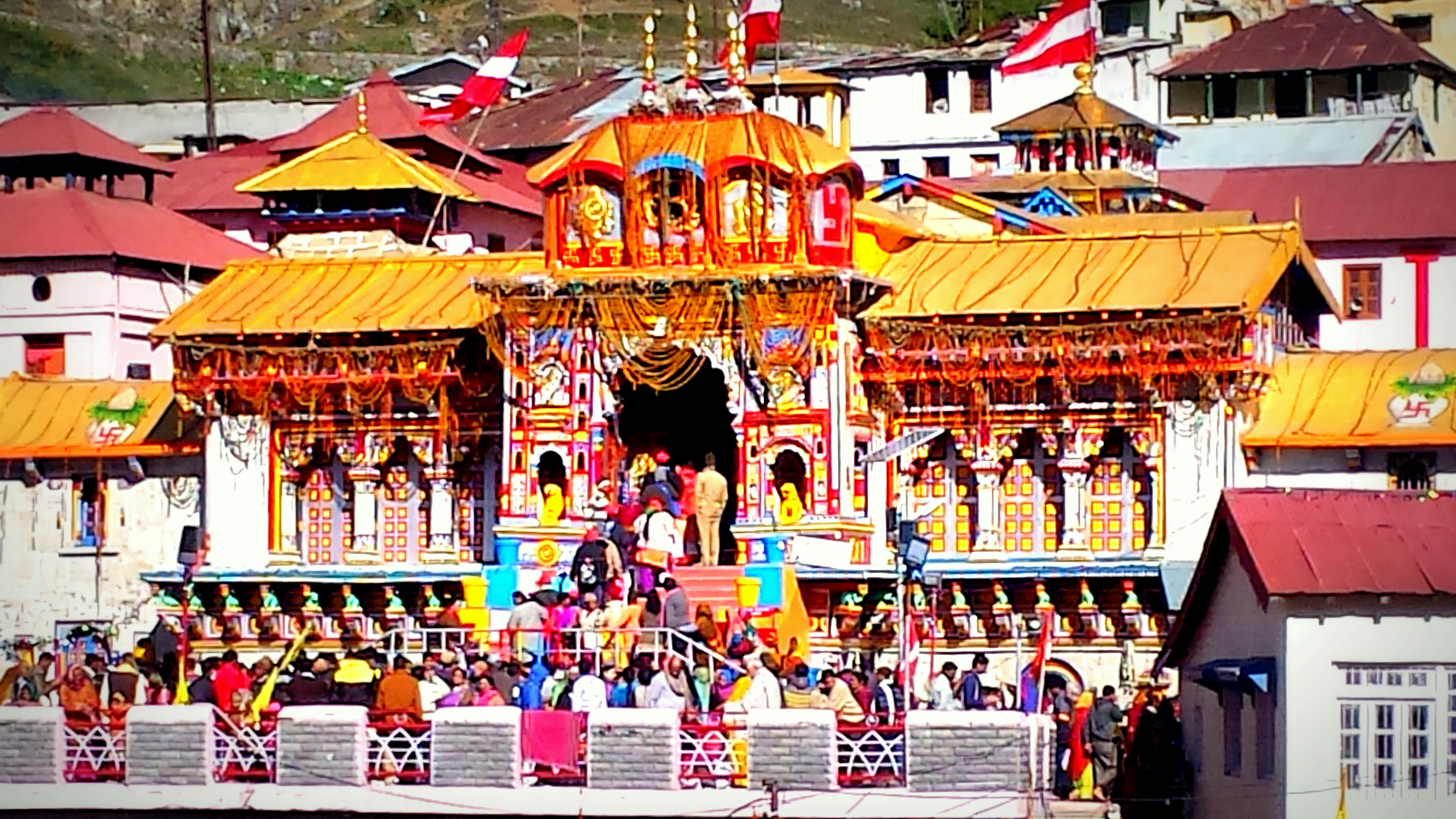
Badrinath Dham is the only Shrine which is a part of both India Char Dham Yatra and Chota Char Dham Yatra..
Badrinath Dham is the only Shrine which is a part of both India Char Dham Yatra and Chota Char Dham Yatra..
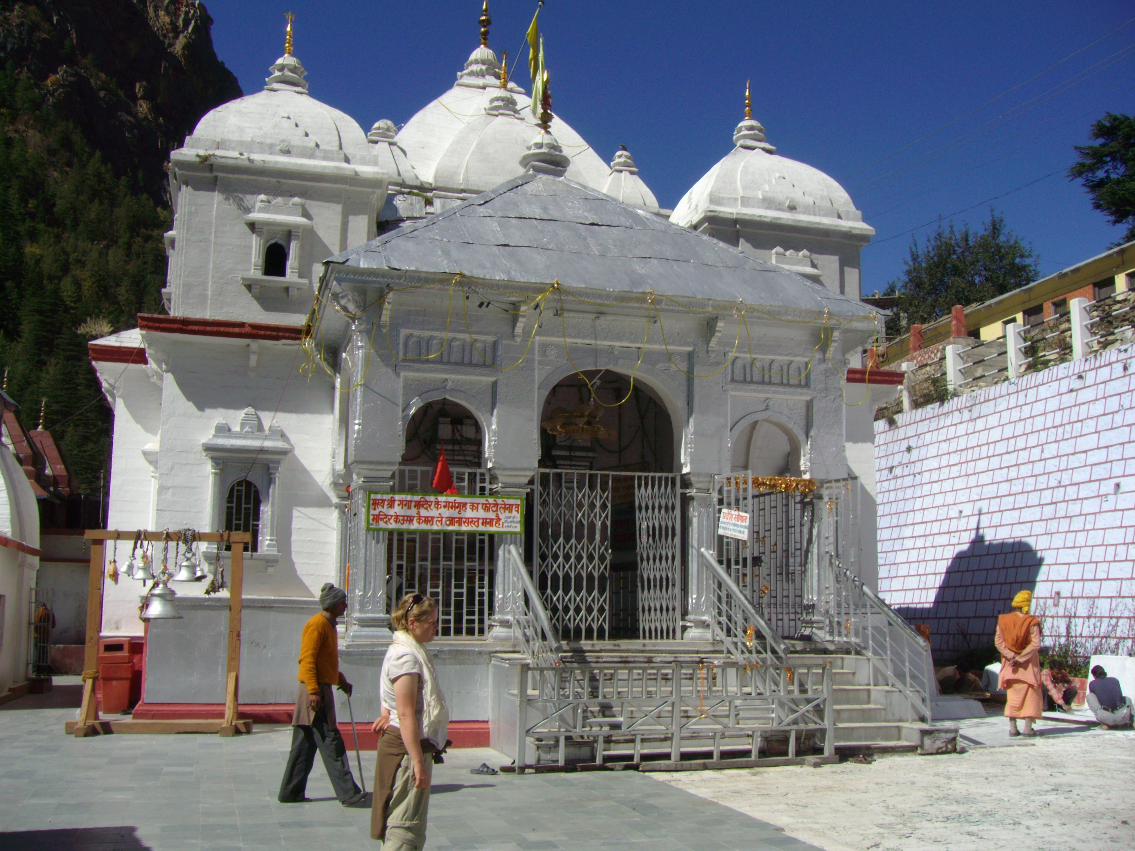
Gangotri is situated at an elevation of 3100 meters above sea level, on the banks of Bhagirathi waterway. Gangotri is..
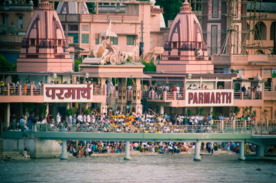
A place where culturally and spiritually lies together. Parmarth Niketan Ashram witnesses the every day evening ceremony of Ganga Aarti Rishikesh.
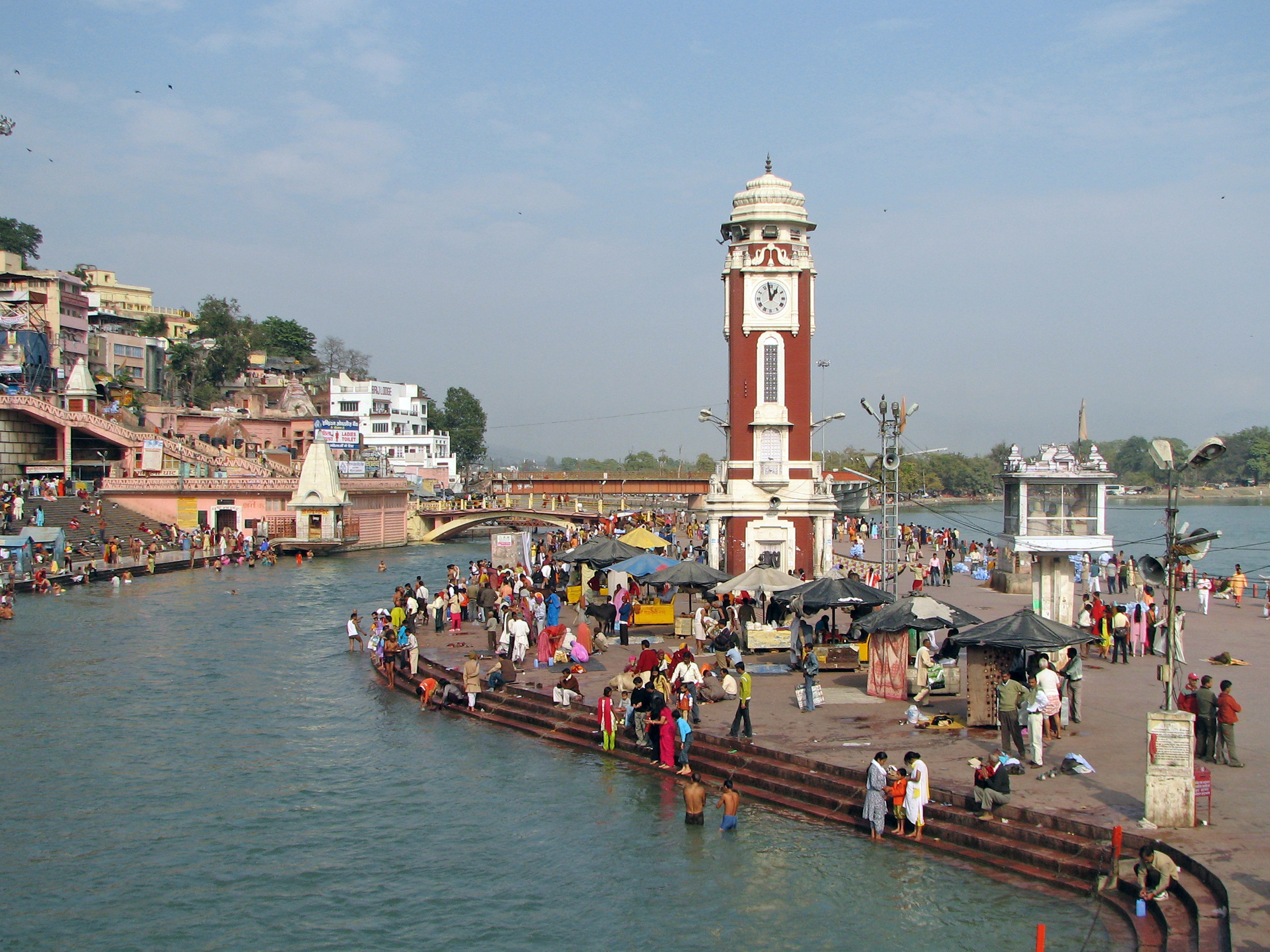
The ‘Char Dham Yatra’ ordinarily start from the pure city of Haridwar, which is an important pilgrimage heart for Hindus..
Garhwal is a portion of Uttarakhand state of India. It comprise of 7 district i.e Chamoli, Pauri Garhwal, Uttarkashi, Dehradun,..